%20(1).gif)
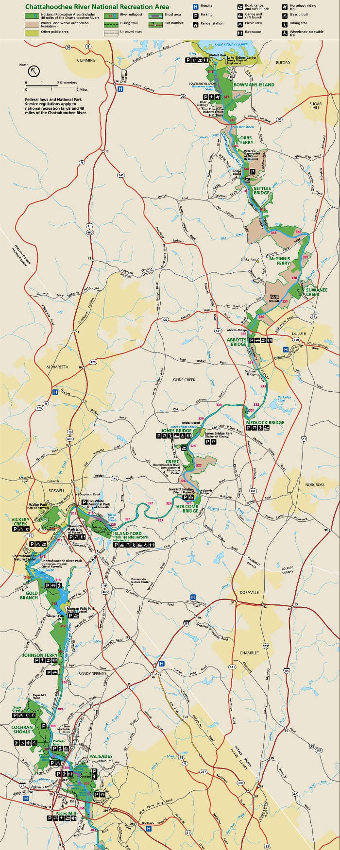
.png) ONE PARK. 15 UNITS.From hiking and biking to paddling and fishing, the Chattahoochee River National Recreation Area (CRNRA) offers an abundance of recreational opportunities for visitors of all ages and interests. With its 48-mile stretch of the iconic Chattahoochee River flowing through metro Atlanta and its surrounding parklands spanning 15 units, CRNRA provides an escape into nature right in the heart of the city.
|

|
| PLAN YOUR VISITBefore you head out to the park, review the trail maps to plan a route perfect for your visit.
Click each unit below to access its map. Looking for an interactive map of CRNRA? View it here! Cochran shoals: Interstate North |
For more information on visiting each park unit, visit Chattahoochee River National Recreation Area's NPS website. |
Join Our Mailing ListStay informed about the latest news, events, volunteer opportunities, and conservation efforts in the Chattahoochee River National Recreation Area. |
Chattahoochee National Park Conservancy, Inc. is a 501(c)3 non-profit organization. We are proud to support our Chattahoochee River National Recreation Area, a unit of the national park system managed by the National Park Service. |
|
www.chattahoocheeparks.org | info@chattahoocheeparks.org | PO Box 769332, Roswell GA 30076 |
|
|
|